\
Imagine a rejuvenated O Street with new State buildings, residential, commercial, and cultural places that creates a unified identity for the Corridor and strengthens its linkages to the State Capitol Campus, R Street, 15th and 16th Street corridors, and Midtown.
Through the Envision O Street planning process, CADA, its partner agencies, and the public have articulated a clear vision for ensuring the corridor serves all users. Following robust community outreach that staff started in May 2018 to guide O Street design elements and solutions, the CADA Board accepted the final Envision O Street Concept Plan in April 2020. This conceptual design plan covers the ten-block segment between 7th and 17th Streets. By building on existing assets and the unique character of the area, this plan describes streetscape design strategies that will increase the safety and comfort of all travel modes and create a network of welcoming public spaces that will contribute to establishing O Street as a premier pedestrian-scale corridor.
Background:
O Street connects the State Capitol Campus, several State offices, light rail stops, various high-density residential projects, and pockets of local retail opportunities. However, a lack of strong connection and identity between these various nodes of activity have left O Street feeling empty and bleak for the many commuters and residents who ride transit to the core of Downtown. Difficult pedestrian and bicycle crossings hinder realization of O Street as a “major pedestrian pathway linking the majority of capitol Area destinations” as was envisioned by the State of California’s Capitol Area Plan. Numerous large surface parking lots further diminish this area’s potential as a premiere pedestrian corridor in Downtown.
CADA is an active participant in efforts to improve the physical appearance of O Street and to enhance its role as an east-to west corridor and as a key stop for people moving across it from north and south. CADA has completed several upgrades to O Street in the past several years and is working to catalyze many more.
Outreach:
On June 28, 2018, CADA held an outdoor pop-up workshop to introduce the O Street Project to the public and invite community input on the assets and constraints along the corridor and opportunities to improve it. The Pop Up Event Summary provides an overview of public input.
On October 3, 2018, CADA hosted two community workshops to seek feedback on the emerging streetscape design.
From December 2018 through June 2019, CADA conducted an online survey to present the emerging design to a wide audience of stakeholders, including State workers, businesses, residents and others, and to seek specific feedback on an emerging draft design framework. CADA received responses from more than 170 people who provided over 1,500 individual comments. The vast majority of the comments were supportive of the emerging design. The Board accepted the final Envision O Street Concept Plan in April 2020. CADA staff is working with the City of Sacramento to explore how the Envision O Street Plan can be incorporated into City policy documents and implemented.
7th to 11th Street Segment:
Starting at 7th Street and continuing to 15th Street, key State office buildings, State garages, and State parking lots either front onto or back up to O Street. These include the Employment Development Department, the Resources Agency, Caltrans, the Department of Food and Agriculture, the Department of Veterans Affairs and the Department of Education.
From 7th Street to 12th Street, CADA funded a project to repaint RT’s light rail station light poles, centenaries, benches and loading ramp railings. CADA completed the work in 2014.
16th Street Intersection:
CADA’s developer partner, Ravel Rasmussen, constructed Legado de Ravel, which includes 84 residential units on formerly-vacant lots to the north and south sides of O Street on the west side of 16th Street. As part of that project, the developer constructed the O Street components of CADA’s 16th Street Streetscape Concept. The improvements include new bulb-outs and storm water retention planters, which were constructed with a Proposition 84 grant from the Strategic Growth Council. The landscaped bulb-outs reduce the distance pedestrians have to travel to cross 16th Street and O Street, make motorists, bicyclists and pedestrians more visible to each other, and generally improve pedestrian safety. The storm water retention basins trap rainwater from 16th and O Streets and channel it into landscaped retention basins that detoxify the water and direct it into the subsurface.
Next Steps:
CADA is focusing on implementing proposed improvements outlined in Chapter V of the Envision O Street Concept Plan. Most immediately, CADA is redesigning the landscaping and public art plaza on the 900 block of O Street. The Plan calls for conversion of all remaining turf into a climate-appropriate landscaping, as well as creating a major link in the pollinator pathway for habitat connectivity between the planted areas along the corridor, including the three new State office buildings on the 700, 1000, and 1200 blocks of O Street.
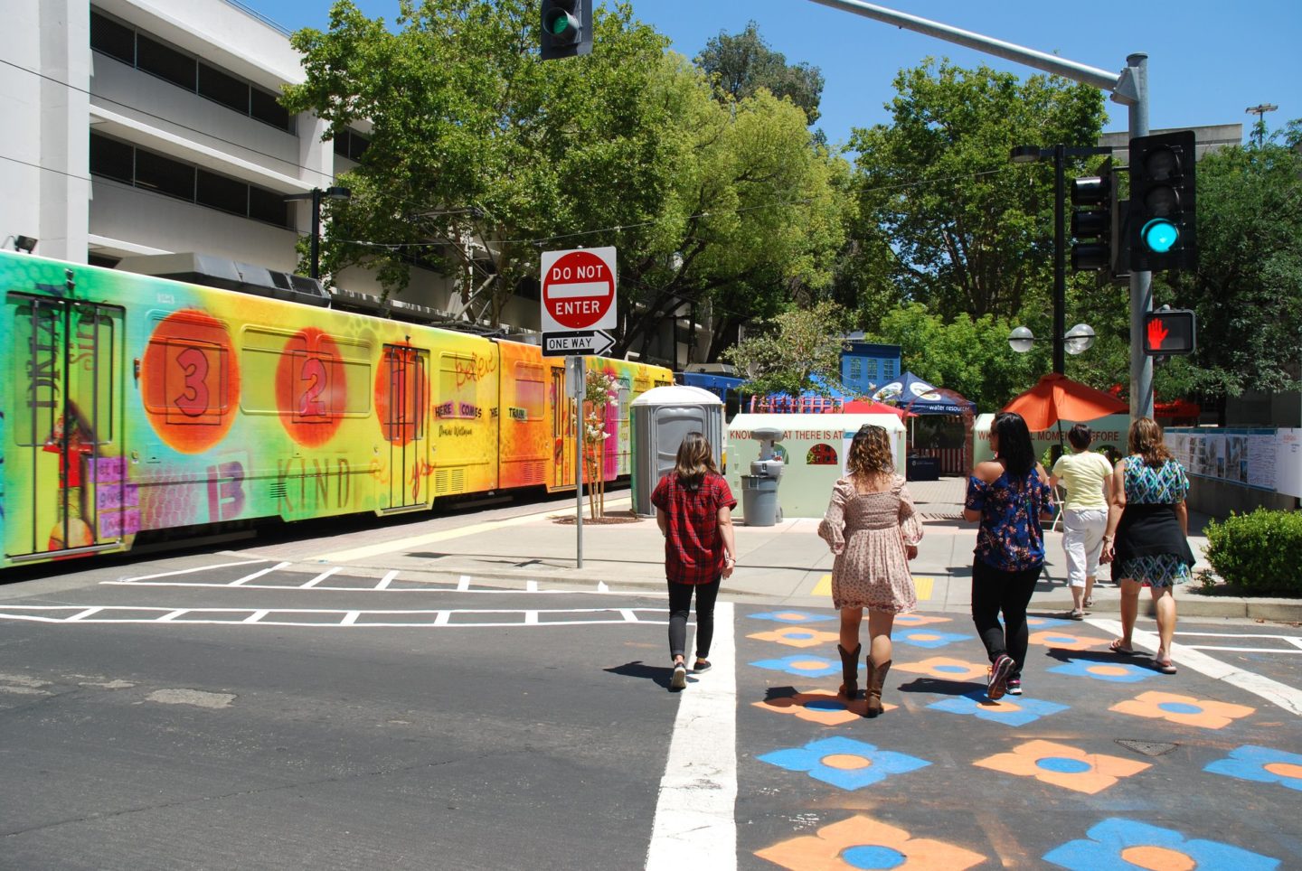
Staff is also working with the City of Sacramento on creative crosswalks and installation of pedestrian safety flashers at the 15th and O Street, and advocating for installation of corner bulb outs and creative crosswalks at 14th and O Street.
CADA Contact:
Marc de la Vergne, Deputy Executive Director
916-324-3913

